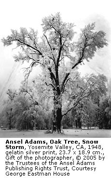
Galen was also amazing to me because he took long hikes when he was in his 90's!
Hikes I can't make today. Ugh.
Here's a couple (and this is before there were groomed trails):
Upper Yosemite Falls
Distance: 7.6 miles (12 km) round trip from the Lower Yosemite Falls trailhead; 9.4 miles (15 km) including Yosemite Point
Elevation at trailhead: 3,967 feet (1,347 meters)
Elevation at top of Yosemite Falls: 6,526 feet (1,989 meters)
Elevation at Yosemite Point: 6,936 feet (2,114 meters)
Elevation gain: 2,600 feet (790 meters) to the top of Yosemite Falls; 2,969 feet (890 meters) to
Yosemite Point
Hiking Time: 6 - 10 hours. Don't double-book hikes on days when you've got this one on your schedule.
Why hike to the top of Yosemite Falls? It's the mother of all stairmaster workouts, but with one-of-a-kind payoffs you won't get in a gym: panoramic views of Yosemite Valley; the only place outside
Sentinel Dome where all of Yosemite Falls is visible (though you can't actually see it all at once unless you've got Exorcistesque peripheral vision); the chance to walk through the spray from upper Yosemite Falls; the chance to photograph Yosemite Falls and
Half Dome in the same frame; and from Yosemite Point, closeup views of Half Dome that you can only beat by climbing
North Dome.
Best Time to Visit: In the spring or early summer, when the falls are roaring. By August the falls have typically dwindled to a trickle, and by the end of summer they often dry up altogether. Check out the
Yosemite Falls webcam to see how much water is currently flowing over the falls.
Difficulty: High. It's a long, steep climb from the valley floor to the valley rim, and easily rates an 8 out of 10. Consider this question: would you climb the stairs all the way to the top of the Empire State Building? Well, in the course of your hike to Upper Yosemite Falls, you'll climb the equivalent of just over two Empire State Buildings
Another, equally strenuous hike is to go to the other side of the valley and hike up to Glacier Point. Here's a picture of Teddy Roosevelt and John Muir at the top
From another angle, it's about a mile down
Glacier Point to Yosemite Valley(strenuous)
Four Mile Trail: 4.8 miles (7.7 km) one-way; 3 to 4 hours
Panorama Trail: 8.5 miles (13.6 km) one-way; 6 to 8 hours
Begin at Glacier Point (Four Mile Trail begins north of the store; Panorama Trail begins south of the store)
It is strongly recommended that you take the
hikers' bus to Glacier Point and hike down, rather than parking at Glacier Point and planning to catch the hikers' bus back up.
The Four Mile Trail switchbacks down to Yosemite Valley, providing wonderful views of the Valley.
The Panorama Trail provides a close-up view of Illilouette Fall and panoramic views of eastern Yosemite Valley before joining the Mist or John Muir Trails down past Vernal and Nevada Falls.


